Mayhura - Gulzor Wall
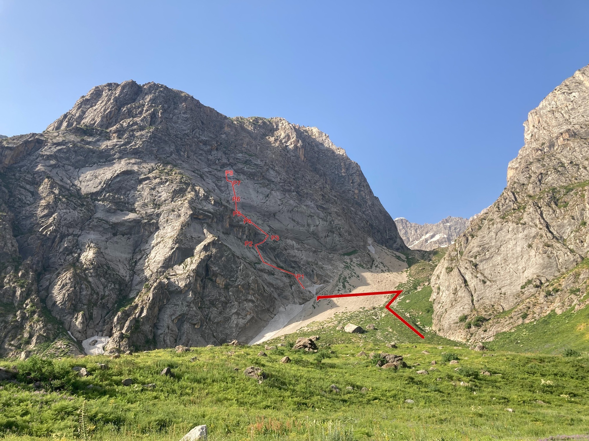
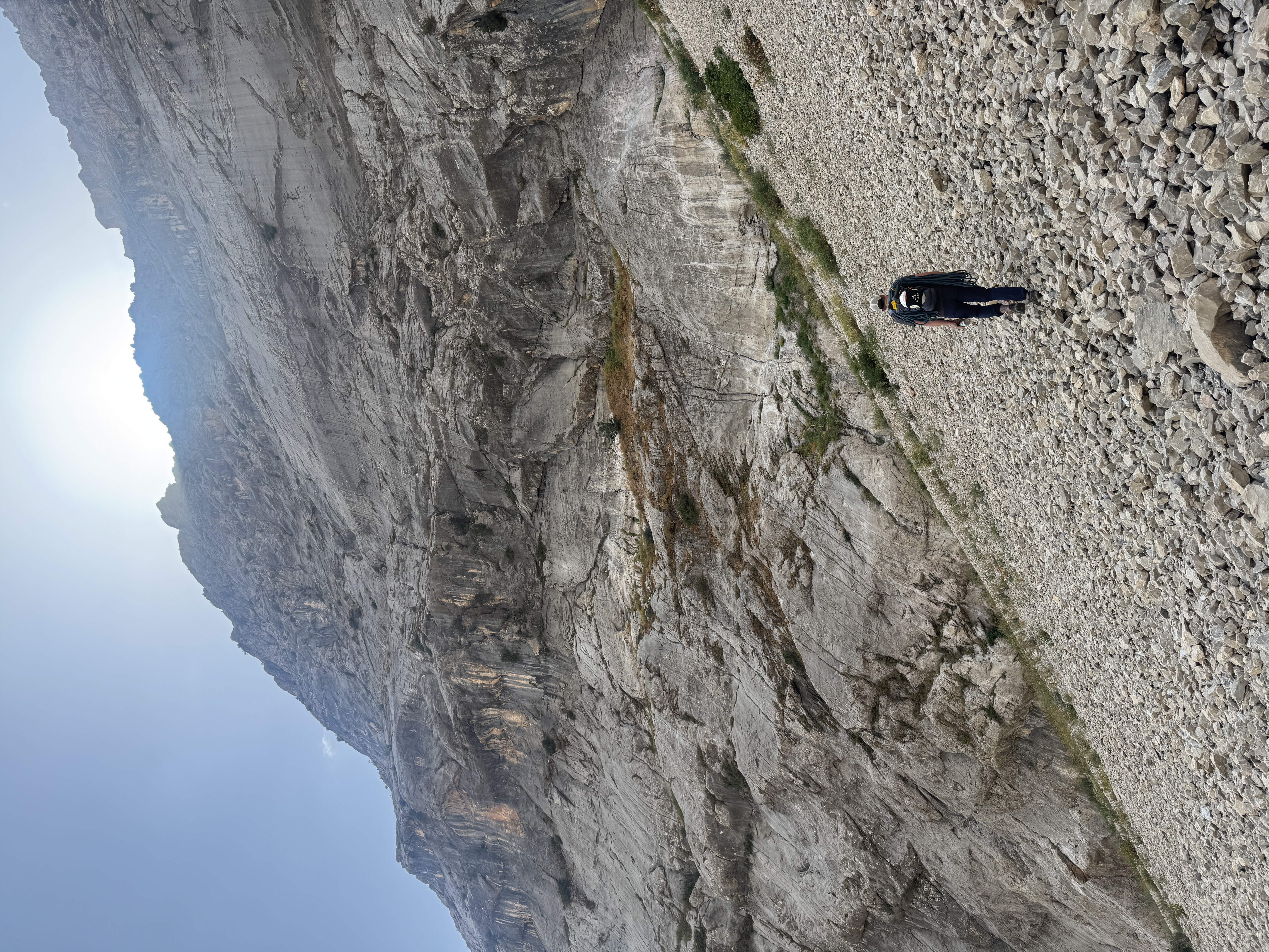
Beautiful and mostly uninhabited valley, seldom frequented by climbers, often frequented by sheep. The most accessible rock is high quality limestone. Glaciers still exist high in the tributary valleys, but there are signs of glaciation much lower down in the distant past. Very little is developed so far, but the rock is very high quality and there is room for many more long multi-pitch or single-pitch routes.
The Gulzor Wall lies above the Maihura River and is clearly visible across the valley from the road up to Istiklol tunnel. There is an extensive slab of rock on the lower 2/3rds of the peak, rising above the plateau area locally known as “Gulzor”. The rock is limestone, and is marked by distinctive runnel features which make for very interesting climbing, there is extensive potential on this slab for additional routes.
The information on this page is copied from Mountain Project with the agreement of the author.
Dissolution
5.10c / 6b · 258 m (850 ft) · 8 pitches · Grade III · sport
FA: Daniel Birdwell, Teddy Langhout, Ivan Buryak, November 2025; FFA: DB, IB, August 2026
This is an excellent new route put up by Teddy Langhout and Daniel Birdwell in the Autumn of 2025, and makes its way up the prominent limestone slab of what we are calling the Gulzor Buttress. The most notable feature are the deep runnels that run nearly top to bottom on this slab. We originally spotted these features from the road on the opposite side of the valley, and after several recon trips, finally put it together.
The most prominent of the runnel features start on the 6th pitch, and they are truly amazing. Up until that point there is a mixture of easier and moderate slab climbing, and a very interesting hand traverse, all quite reasonably protected with bolts. The steep runnel pitch goes around 5.9/5.10a or 6a. The next is quite long, 50 m, following slabby runnels, past a slab crux, and up more runnels. The final (for now) pitch is an easy water formed chimney feature which ends on a big ledge. There is more rock above this, a small bowl of rock that leads to a notch. At the moment what lies beyond this point is unknown, but surely leads to the main ridge of this peak.
Pitches
-
P1 — Start on one of the bolted runnel pitches on low angle stone to a large ledge system. 5.3 / grade 2.
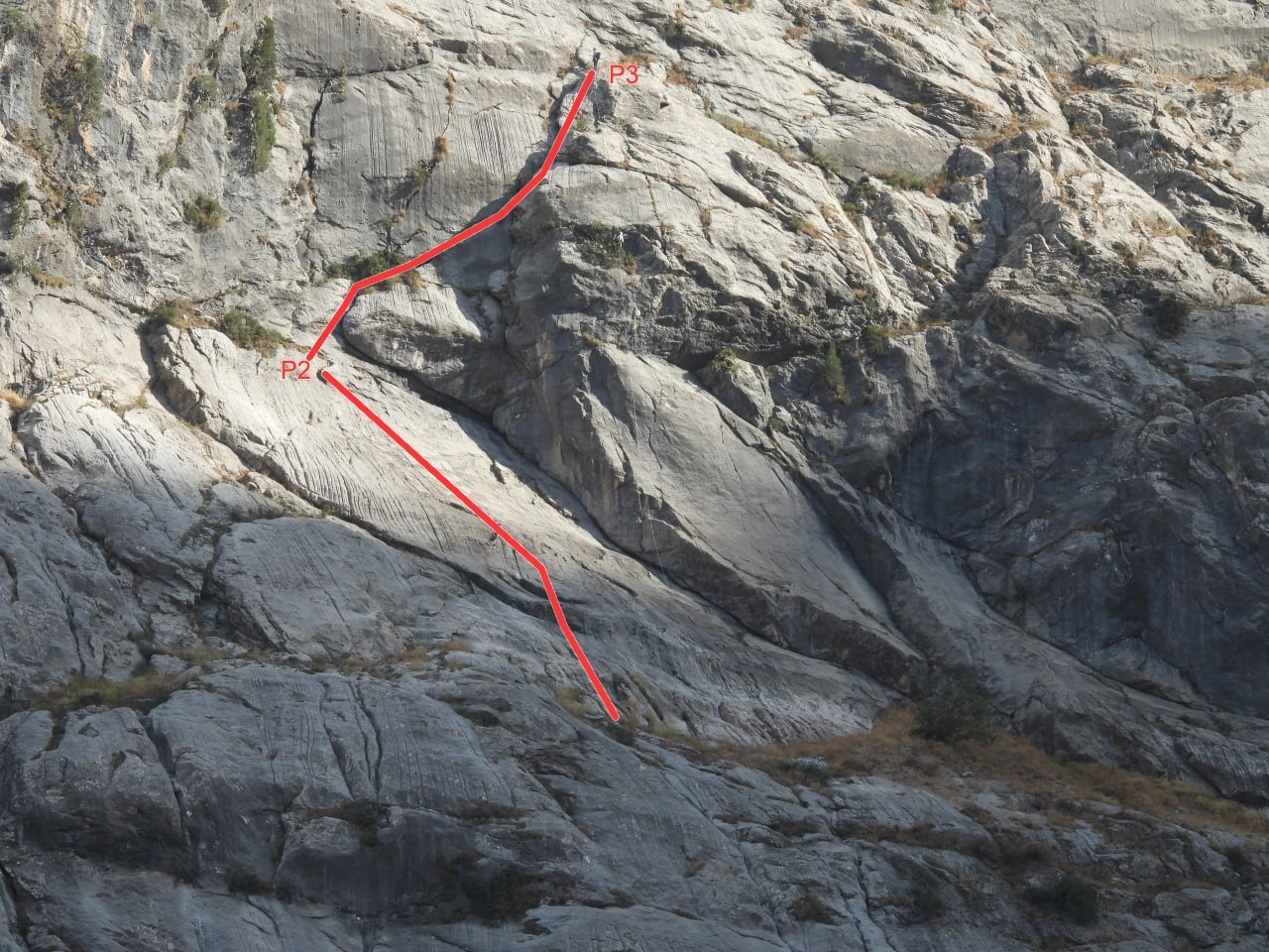
Traverse the slope climber’s left towards another slab (50 m approx), look for a bolted anchor below a juniper tree and a right sloping crack which traverses the steep break in the slabs.
-
P2 — Climb easy steepening slabs, to a small ledge below the steep section of cliff which breaks up the slab. 5.4 / French grade 3.
-
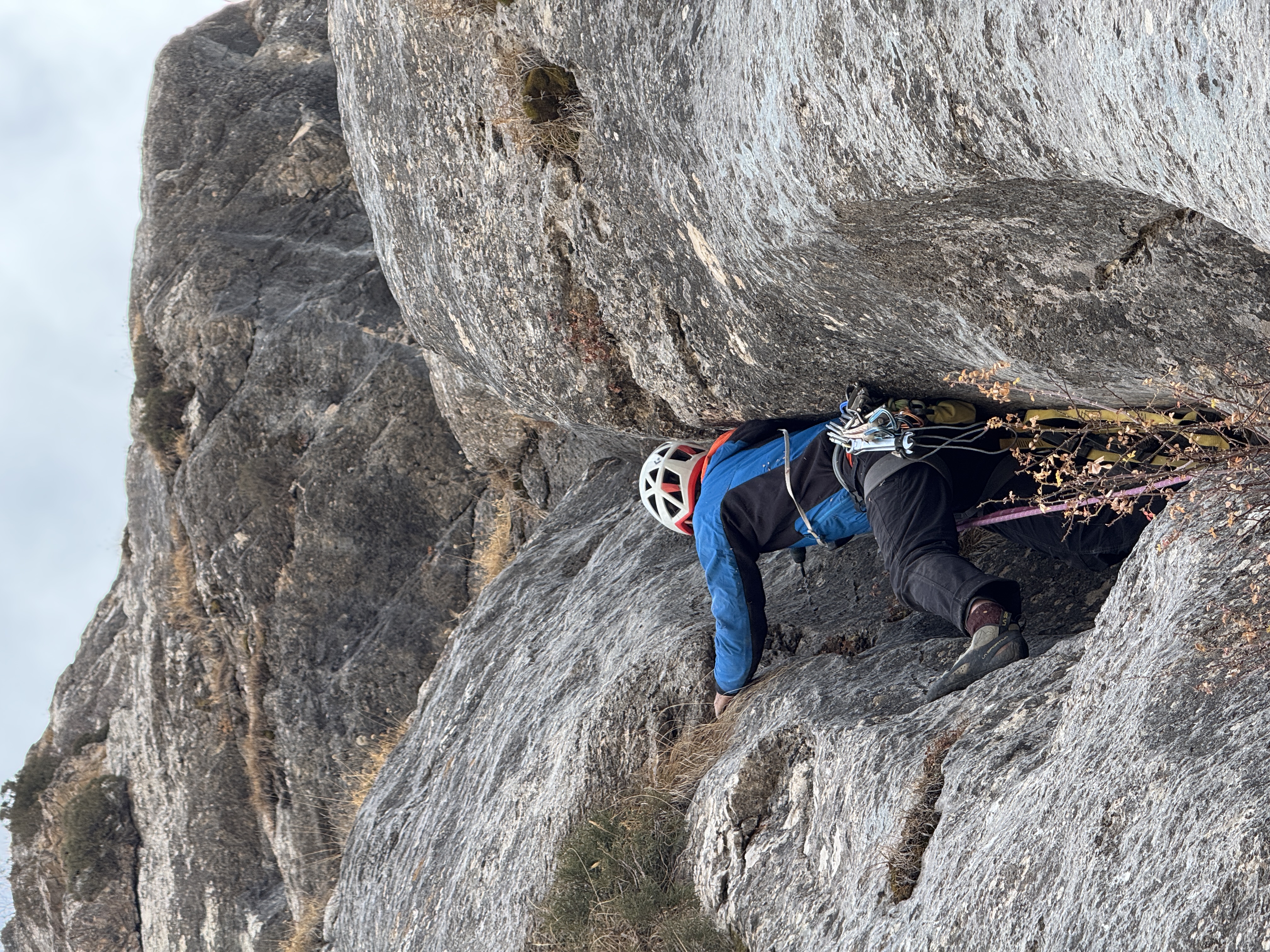
P3 — The worm pitch. Follow bolts up and behind the tree, reaching the horizontal crack. Traverse the crack then step over to the right wall and follow bolts to the next belay. 5.10 / 6a+.
-
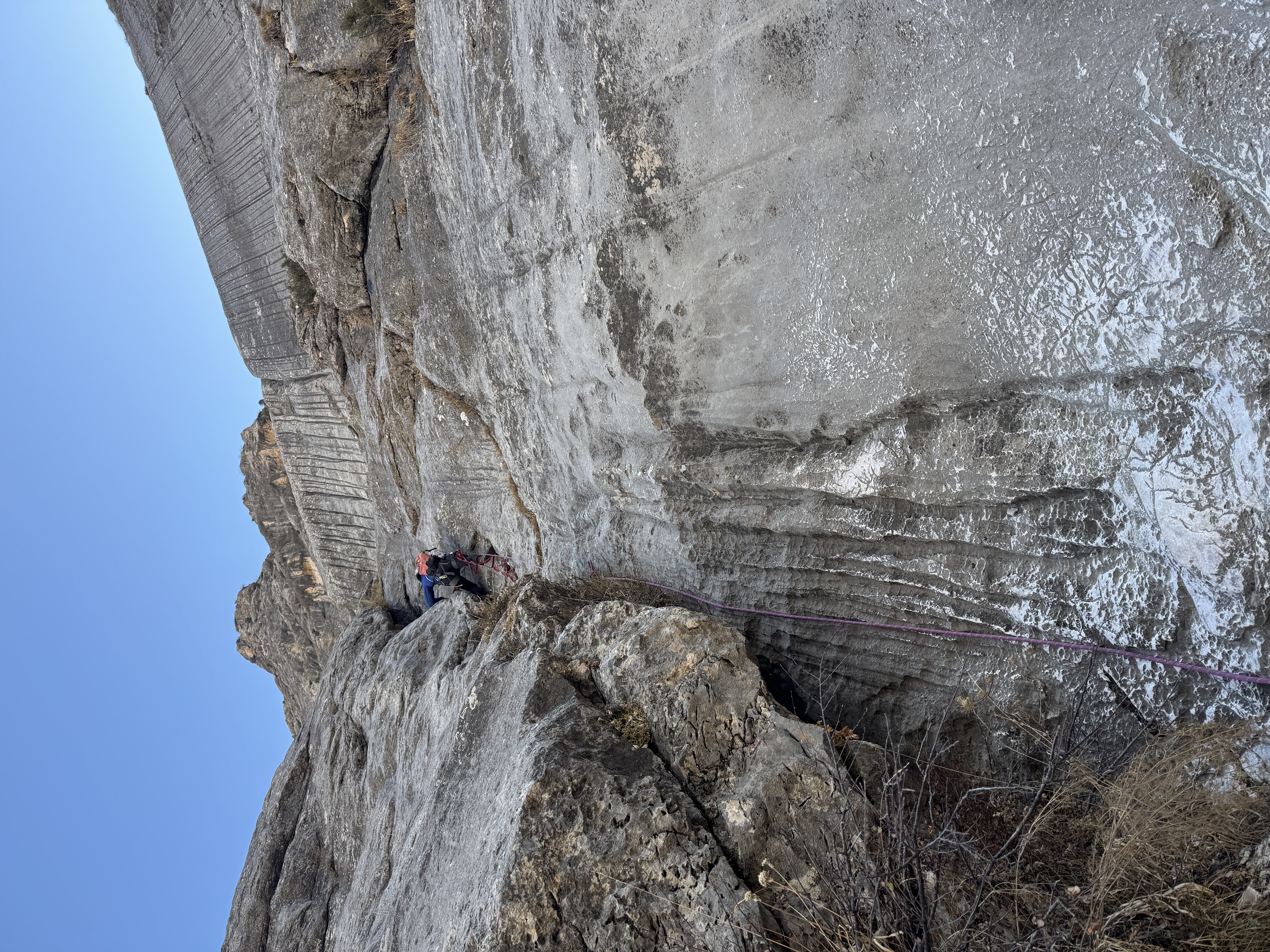
P4 — A nearly direct leftwards traverse protected by bolts and one piton. 5.8 / 5a.
-
P5 — Climb left from the anchor below some bushes, and up to a small alcove at the bottom of a water runnel feature. There are places for a strong seated belay to protect the 2nd coming off of the anchor.
Continue up the obvious dihedral / water feature. 5.6 / 4c. The climbing is easy, but the bolts are quite far from each other — take cams for additional protection if needed.
-
P6 — The steep Runnel Pitch. Follow bolts up this feature, jam, stem and layback up and around the lip and up a slab to a large ledge. Many options exist for this pitch, and we plan to put several more routes up this feature. 5.10a / 6a.
-
P7 — The Long Slab runnel pitch. Follow bolts up a slab covered in runnel features. After the first set of runnels there are a few moves (probably the crux) leading to a slanted ledge, and then up a final set of runnels to another large ledge. 17 protection bolts. 5.10c / 6b.
-
P8 — There’s a cool chimney feature on the left side of this slab, it’s bolted and lots of fun! Leads up to another great ledge.
Protection
Bolts and bolted anchors, P7 has 17 protection bolts. Requires 2 ropes to rappel!
Finding the start
Beta photos are best for finding the start. Look for the very distinct runnel features high up on the wall, start on the slabs below, and slightly to the climber’s right of this feature. There is a small trail to the right of the scree slope that ascends the valley feeding down towards the parking area. Once you are roughly level with the slab, cross the scree. A large cave / dihedral feature is the far right side of this section of wall.
Getting there
The plateau can be reached via a 4x4 road starting at 39°02.297’ 68°45.619’. Follow this road until a small settlement, cross the bridge, or drive through the creek and then up a steep track that climbs up onto a plateau. There is a small summer home you can park near and hike from there.
Links
All locations
About this place
- Location: Varzob
- Routes: 1
- Tags: multi-pitch, sport